Tuesday May 11th 2021 - number of obs: 1440 (100%)
|
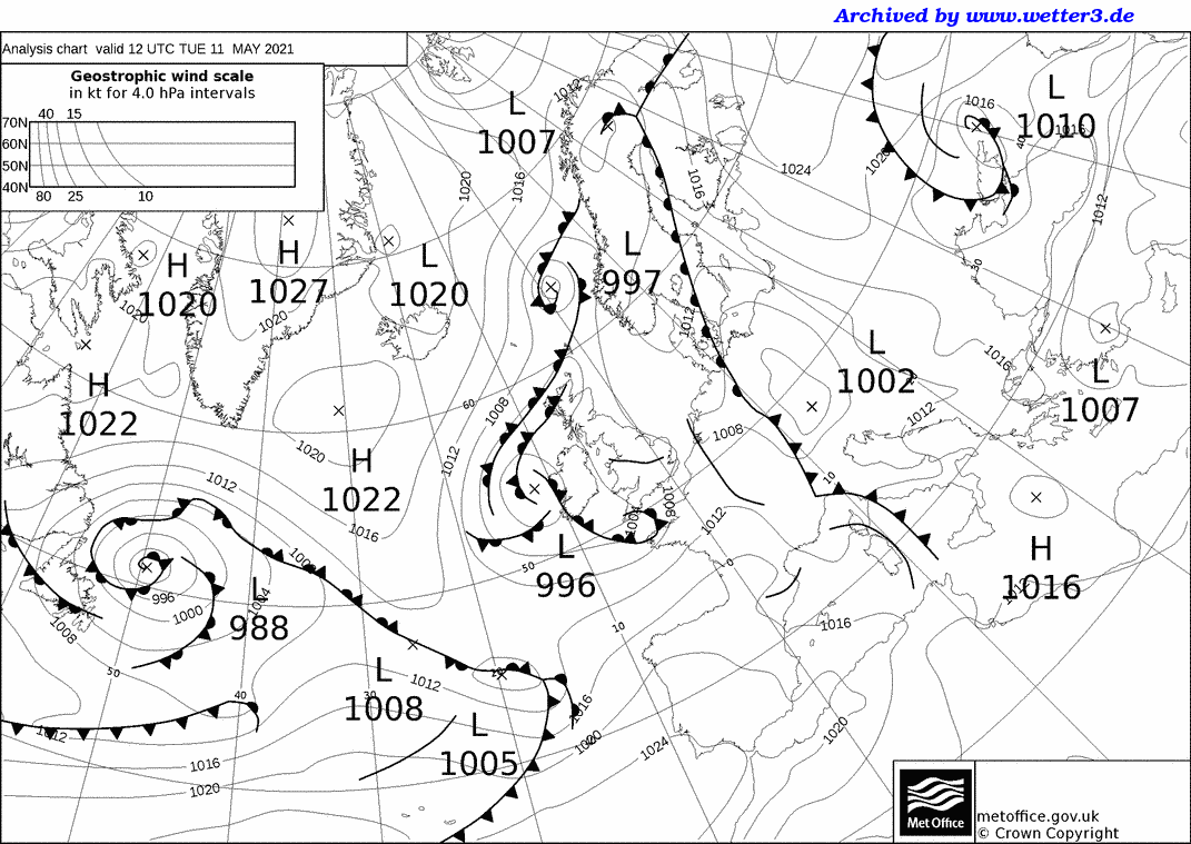
Met Office 12Z Analysis Chart |
||||||||||||||||||||||||||||||||||||||||||||
 |
Daily Diary Fine start, but cloud soon developed in the unstable S'ly flow, with a band of heavy showers developing just to the west, but moving north. Convection was suppressed during the early afternoon with the invasion of high/medium cloud from the SW, associated with a small low pressure system. This brought with it, by mid-afternoon, a low-topped supercell which tracked NNE from the Exe Estuary, across Exeter, Cullompton, and towards Weston-super-Mare. The mesocyclone was captured by the timelapse (just after 1530Z), and a brief tornado was suspected with a cluster of minor damage reports in the Knightswood area (North Cullompton). Marked pressure kick and wind shift associated with it, followed by clearing skies and a moderating W'ly wind. Temperatures by day slightly below average, with a cool night to follow under clearing skies. RoostCam South Timelapse | RoostCam North Timelapse |