Friday June 25th 2021 - number of obs: 1440 (100%)
|
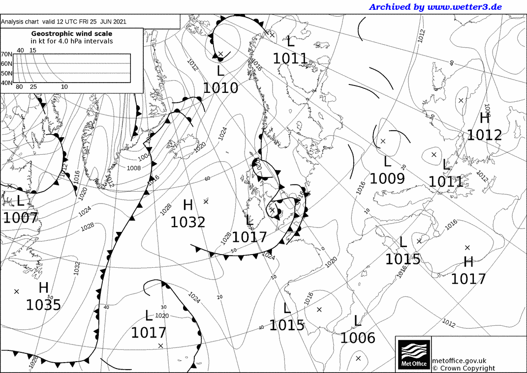
Met Office 12Z Analysis Chart |
||||||||||||||||||||||||||||||||||||||||||||
 |
Daily Diary An overcast, wet start associated with a cold front coming southwards. Cloud gradually broke up during the late morning to leave reasonable sunny spells, although it did remain largely cloudy overall. Rather cool, with a light W'ly wind. An interesting event overnight was an undular bore evident running southwards on imagery, this wrapped itself into the vortex and provided a focus for heavy showers which gave flooding to NW England. At the same time, a higher dew-point hang back from the clearing cold front combined with sea-breeze convergence and increasing forcing associated with an upper vortex to produce an area of torrential downpours which spawned a tornado in Barking during te early evening. RoostCam South Timelapse | RoostCam North Timelapse |