Sunday February 20th 2022 - number of obs: 1440 (100%)
|
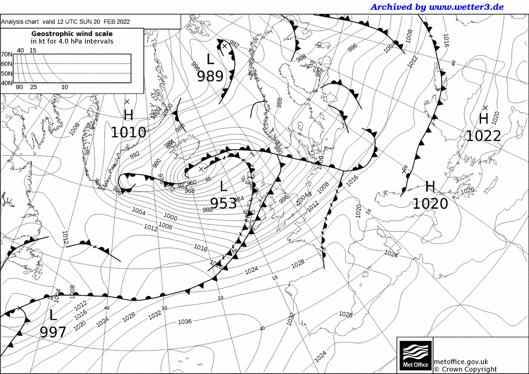
Met Office 12Z Analysis Chart |
||||||||||||||||||||||||||||||||||||||||||||
 |
Daily Diary Mild, cloud and increasingly windy night, the warm sector associated with Storm Franklin to the NW of the UK providing a bit of patchy rain and overcast conditions. Squally cold front arrived just after 1700, with a sharp pressure kick and wind veer. A period of clearing skies followed, before some showers began to arrive from the NW. Very mild, exceptionally so overnight, but turning colder (towards average) during the evening. Fresh to strong WSW'ly becoming W'ly winds. RoostCam South Timelapse | RoostCam North Timelapse |