Thursday March 9th 2023 - number of obs: 1440 (100%)
|
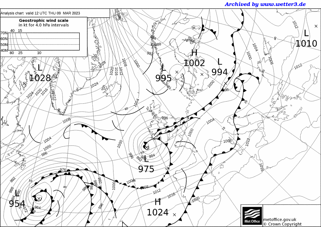
Met Office 12Z Analysis Chart |
||||||||||||||||||||||||||||||||||||||||||||
 |
Daily Diary Rain eased off for a few hours overnight, before returning N across the area on a returning warm front. Persistent rain into the morning, with overcast skies, before conditions turned more convective and showery, with the odd brighter break in the clouds in the warm sector. Cold conditions rapidly turned to mild. Further persistent rain arrived associated with the cold front, but the real air mass change wasn't until the occlusion arrived during the early hours of the following morning. This system was named Storm Larisa by MeteoFrance, and whilst it was windy across parts of the far SW, the main impact was heavy, persistent snow, which led to over a foot of snow across parts of northern England, even at relatively low levels, N Wales and E Northern Ireland too. Amber warnings were issued, and the M62 was shut with people trapped in their cars. With a squeeze over the Pennines, locally the winds were also very strong within the snow, adding to the impacts, drifting and the odd tree blown over. RoostCam South Timelapse | RoostCam North Timelapse |